Friday, March 29, 2013

March 2013 - Colder & Snowier Than Average


March 26, 2013
Along The High Knob Massif Crest Zone
Looking Like Mid-Winter In Spring 2013
Photograph by Bill Harris - © All Rights Reserved.


As the first month of meteorological spring approached its end yet another blast from the 
Ole Man of Winter transformed the mountain landscape into a wonderland of snow and rime.

March 26, 2013
Along The High Knob Massif Crest Zone
Entrance To High Knob Lake Recreation Area
Photograph by Bill Harris - © All Rights Reserved.

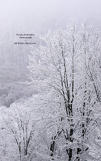
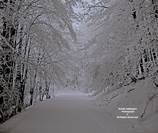
This was a prolonged event with continuous snow falling from March 24-27 in upper elevations of the High Knob Massif, and during March 25-27 at mid and lower elevations along the upslope side of the southern Appalachians.

March 25, 2013
Southern Wise County
Beginning Of A Prolonged Upslope Snow Event
Photograph by Roddy Addington - © All Rights Reserved.

Rod Addington Photography

Darlene Fields said if spring was never coming at least she had a nice "Snowball Bush" in her yard!

March 26, 2013
High Chaparral of High Knob Massif
Snowball Bush Of Ole Man Winter's Design
Photograph by Darlene Fields - © All Rights Reserved.


History Of The Miller B
Winter Storm of March 24-27

Climatology dictates that most of the snow with winter cyclones of the Miller B type typically falls with upslope flow amid the backside circulation of these systems along the western Appalachians.

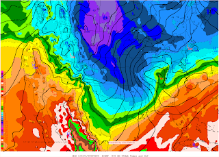
March 24, 2013 at 8:00 AM ( 1200 UTC )
European Model 850 MB & Surface Initialization

That certainly was the case with this system, as the Warm Air Advection ( WAA ) snow of the frontside fell within the Cold Air Damming ( CAD ) zone generated by evaporative cooling and transport of colder air into eastern slopes of the Appalachians.

Snow totals with this Miller B Storm's WAA phase were much less than those associated with the Miller B storm of March 5-7 when 18-24 inches accumulated at highest elevations of the northern
Blue Ridge in Virginia.  Upslope snow along the western slopes, by contrast, was much greater during March 25-27 vs. March 5-7.

March 24, 2013 at 8:00 PM ( 0000 UTC )
European Model 850 MB & Surface Initialization

Miller B cyclones are typically complex, especially as regards the vertical temperature profile, since an initial low center tends to propagate along the western slopes of the Appalachians as a secondary low forms to the east, lee of the mountains.  The secondary low then becomes the primary storm center as the western low weakens.

Miller A Verses Miller B Winter Storms
Favorable Patterns For Winter Winter
( Courtesy of State Climate Office of North Carolina )

Snow, sleet, freezing rain or a mixture occurs along 
the eastern Appalachians ( with snow favored farther northeast vs. southeast along the mountain chain ) as a deeper layer of warm air aloft supports mostly rain along the western Appalachians during this WAA phase.

The Cold Air Advection ( CAA ) phase, as highlighted in detail below, being typically the most productive snow producer along the western front range of the Appalachians with Miller B storms.

[ Miller A Winter Storms, especially northward tracking variants, like exemplified by the crippling snow falls of January 1998 and December 2009, are completely different animals and can be potent snow producers ].

March 25, 2013 at 8:00 AM ( 1200 UTC )
European Model 850 MB & Surface Initialization

Rain changed to wet snow at highest elevations in the High Knob Massif, above 3300 feet, during evening hours of March 24 on SW-WSW 
low-level air flow trajectories.  

A general 1-2" accumulated on Eagle Knob ( 4189 feet elevation ) before snow even started to stick much at the 3300 foot level in High Chaparral ( 4.1 air miles east of the High Knob peak ).

Snowfall increased significantly 
into morning hours of March 25.

A backward air flow trajectory calculation using the NOAA HYSPLIT Model also revealed that the air had a notable Great Lake connection.


It was no surprise to find abundant moisture on the 1200 UTC NAM Model Initialized Sounding above Wise ( with 12-18 hours of steady upward rising motion aiding condensation and snowfall ).

March 25, 2013 at 8:00 AM ( 1200 UTC )
NAM Model Initialized Sounding Above Wise

This marked a period of SW-WSW upslope flow that produced a general 1" to 5" of snow depth in the typically favored SW Upslope Flow snowfall zone by mid-day on March 25 ( * ). 

*The SW Upslope Flow zone extends from the High Knob Massif and Tennessee Valley Divide southwest through Norton-Wise 
into the Powell River Basin of Lee County.

( Climatology of SW Upslope Flow Snow )
SW Upslope Flow Event of February 2013

( 3.5" of Snowfall )
March 25, 2013 at 11:02 AM
High Chaparral of High Knob Massif
Photograph by Darlene Fields - © All Rights Reserved.

During this same time only a dusting of snow accumulated in much of the Russell Fork and Levisa Fork basins on downslope flow into communities such as Pound, Clintwood, 
Haysi, and Grundy.

March 25, 2013 ( Monday )
Middle Elevations of SW Upslope Flow Zone
Morning Snow & Slick Roads In Wise County
Photograph by Roddy Addington - © All Rights Reserved.

Residents in northern Wise County wondered why school was closed Monday to illustrate the large contrast in conditions between locations such as Pound & Wise ( elevation + upslope/downslope = large contrast ).

March 25, 2013 In Wise County
Wise Plateau of Tennessee Valley Divide
AM Conditions In WSW-SW Upslope Flow Zone
Photograph by Roddy Addington - © All Rights Reserved.

A large contrast was also observed in Dickenson County, between Sandy Ridge and Clintwood, but county schools were out for "spring" break!

March 25, 2013 at 9:51 AM
Long Ridge of Tennessee Valley Divide
Maple Buds Of Spring Contrast With Snow
Photograph by Wayne Riner - © All Rights Reserved.

Wayne Riner Photograph Thoughts...
"The maple tree has red buds in the process of blooming.  However, Monday morning's snow is 
in contrast to spring on the calendar."

March 25, 2013 at 8:00 AM ( 1200 UTC )
European Model 500 MB & Surface Initialization

Another factor aiding snowfall on the synoptic scale was cold air aloft associated with a closed 500 MB low passing across the Appalachians, with low-level wind trajectories backing WNW-NW into the afternoon and evening hours of March 25.

This contributed to snow squalls with bursts of heavy snow during the afternoon.  Sticking and melting occurred at lower elevations, with significant accumulations observed above 2500 to 3000 feet ( especially in the High Knob Massif - Black Mountain corridor ).

( 6.5" of total snowfall )
March 25, 2013 at 5:10 PM
New Snow In High Chaparral of High Knob Massif
Photograph by Darlene Fields - © All Rights Reserved.

Darlene illustrates the most accurate way to measure snowfall, with snow on the left side of her picnic table above having been swept clean from the morning accumulation.  The snow on the left seen above having accumulated in the 6 hours between 11:02 AM and 5:10 PM 
( 3.0" of new to make 6.5" in total ).

This method of measuring follows National Weather Service Cooperative Guidelines and The Snow Booklet 
as outlined by The Colorado State Climate Center.

Colorado State University - The Snow Booklet

Elevation 3300 feet
High Chaparral of High Knob Massif
New Snow Swept Clean Again At 5:11 PM
Photograph by Darlene Fields - © All Rights Reserved.

Ideally, snow should be measured and swept every 6 hours that it accumulates.  You do not want to sweep off the snow more often than every 6 hours or it could erroneously inflate the storm total fall.  On the other hand, if snow sticks and then melts each sticking should be measured or estimated and added to make the total fall.
A total of 4 intervals of 6 hours with accumulation = the 24-hour snowfall total.  If snow melts continuously and never sticks the total is counted as a trace.

Snow is measured and swept in order to minimize factors such as settlement, compression, and other processes like sublimation and melting that alter the snow depth over time.  Wind can also be a major factor hard to deal with, requiring long-time ( veteran ) snow measuring skills in order to determine its impact and obtain a reasonably accurate estimate for the total fall.

Prolonged snow events like this present an added challenge, with higher spring sun angles and the tendency for melting by day and sticking at night having to be understood and recognized in order 
to capture the amount of snow that really falls.

Variations observed at UVA in Wise are illustrative.

March 25, 2013 at 10:27 AM
University of Virginia's College In Wise

Note the considerable amount of melting which occurred 
between 10:27 AM ( above ) and 3:26 PM ( below ).

March 25, 2013 at 3:26 PM
University of Virginia's College In Wise

New sticking occurred in late afternoon ( below ).

March 25, 2013 at 6:08 PM
University of Virginia's College In Wise

By 5:10 PM on March 25, when Darlene Fields had measured 6.5" of total snowfall in High Chaparral, there had been less than 0.5" of accumulation at my station in Clintwood.

A general 8" to 9" of snow had accumulated along the main crest zone of the High Knob Massif by 5:00 PM on March 25, with heavy snow accumulations as well along Big Black Mountain where KDOT reported 6" of depth on State Route 160 by 1:32 PM.

March 25, 2013 at 8:00 PM ( 0000 UTC )
European Model 850 MB & Surface Initialization

Continuous snow fell on WNW-NNW winds from the evening of March 25 through March 26, with significant additional snow adding to depths at all elevations along the upslope side of the mountains.

March 25, 2013 at 8:00 PM ( 0000 UTC )
NAM Model Initialized Sounding Above Wise

March 26, 2013 at 8:00 AM ( 1200 UTC )
NAM Model Initialized Sounding Above Wise

The major differences in the above soundings being a shift to complete saturation below 800 MB and a backing of the wind field to NW-NNW by 8:00 AM on March 26 above the Wise gridpoint.

March 26, 2013 at 8:00 AM ( 1200 UTC )
European Model 850 MB & Surface Initialization

This kept a layer of pilatus clouds capping the High Knob Massif which acted as feeder clouds through which falling snowflakes would be rimed to aid enhancement of snowfall and depth in the highest elevations ( an orographic effect ).

A calculation of backward air flow trajectories at 
6 hour intervals into the morning of March 26 revealed a significant Great Lake connection to supply the needed low-level moisture that was being orographically lifted to generate the riming cloud layer and continuous snowfall across the High Knob Massif.

Backward Air Flow Trajectories At 1000 Meters
( Changes In 6-hour Increments From Left to Right )

Backward Air Flow Trajectories At 1450 Meters
( Changes In 6-hour Increments From Left to Right )

March 26, 2013
Rime Does More Than Add Water Content
Riming In High Knob Massif Crest Zone
Photograph by Bill Harris - © All Rights Reserved.

So rime does more than just add water content to snowpacks, it also acts to aid snowfall itself during periods when snow is falling through the super-cooled clouds of vapor that generate all the riming of trees, bushes, and above ground objects.

This is the seeder-feeder process of the winter, or cold season, atmosphere which enhances precipitation, in this case snowfall, via riming of snow flakes to add both to their fall efficiency and their volume ( as the summer seeder-feeder process works to enhance the amount of rainfall reaching the surface its winter counterpart works to enhance the amount of snow that falls and accumulates on the ground amid the high country where riming is most active and vigorous ).

March 26, 2013 at 8:00 PM ( 0000 UTC )
European Model 850 MB & Surface Initialization

Snow accumulated into morning 
hours of March 27.

Morning of March 27, 2013
High Chaparral of High Knob Massif
Ready For More Snow - Depth Increases
Photograph by Darlene Fields - © All Rights Reserved.


Storm Snowfall Statistics
For March 24-27 & Winter 2012-13

( Northern Base of High Knob Massif )
City of Norton Water Plant 
Observer: Superintendent Andrew Greear
Elevation 2342 feet

Storm Total Snowfall: 10.0” 
( 0.69” of snow water equivalent / 5.83” March )

Max Mean Snow Depth: 8”

March snowfall: 20.8”

2012-13 Season Snowfall 
Total: 65.3” ( 5.4 feet )


Snow Depth On Wise Mountain
Courtesy of Judy Horne & WCYB-TV Photo Archive


( Head of Burns Creek & Little Stony Creek )
High Chaparral of High Knob Massif
Observer: Darlene & Joe Fields
Elevation 3300 feet

Storm Total Snowfall: 13.5”

Max Mean Snow Depth: 11”

March snowfall: 27.0”

2012-13 Season Snowfall 
Total: 90.5” ( 7.5 feet )


High Chaparral of High Knob Massif
Closing In On A Foot of Ground Snow Depth
Photograph by Darlene Fields - © All Rights Reserved.


( South Fork of Powell River Basin )
Little Mountain of High Knob Massif
Observer: James & Carol Bolling
Elevation 3420 feet

Storm Total Snowfall: 14.5”
Large Snow Drifts Along Route 237


( Eagle Knob Communications Area )
Eagle Knob of High Knob Massif
Observer: Steve Blankenbecler & Wayne Browning
Elevation 4189 feet

Storm Total Snowfall: 18.0”
Variable ground depths ( < 6" to >24" )

March snowfall: 36.5”

2012-13 Season Snowfall 
Total: 130.0” ( 10.8 feet )

91 Days ( 13 weeks ) of 1" or More 
Snow Depth In High Knob Lake Basin

March 27, 2013
Eagle Knob of High Knob Massif
Image by Steve Blankenbecler - © All Rights Reserved.

Mid-upper elevations ( > 2000 feet ) of central-southern 
Wise County and extreme northern Scott County had the most snow during this March 24-27 Miller B winter storm episode, with a general 8"-18" of total snowfall.

Ground depths varied from less than 6" to 2 feet or more in drifts, but generally were less than the total fall of snow due to daily melting, settlement, and compaction.


( Along the Tennessee Valley Divide )
Nora 4 SSE on Long Ridge
Observer: Wayne & Genevie Riner
Elevation 2650 feet 

Storm Total Snowfall: 6.1”
( 0.39” of snow water equivalent / 4.39” March )

March snowfall: 15.1”

2012-13 Season Snowfall 
Total: 56.8” ( 4.7 feet )


March 25, 2013 ( Monday )
Cemetery In The Snow On Long Ridge
Photograph by Wayne Riner - © All Rights Reserved.

Wayne Riner Photograph Thoughts...
"The calendar tells of spring and daffodils.  Monday's snow gives us a reality check."


( Lower Elevations of Russell Fork Basin )
Clintwood 1 W 
Observer: Wayne Browning
Elevation 1560 feet

Storm Total Snowfall: 4.3”
( 0.24" of snow water equivalent / 4.31" March )

Max Mean Snow Depth: 2"
( Local snow drifts to 6-7" )

March snowfall: 13.1”

2012-13 Season Snowfall 
Total: 40.5 ( 3.4 feet )


Lower elevations of northern Wise County and much 
of Dickenson & Buchanan counties ( < 2000 feet ) had much less snow with only 1" to 3" on the ground at any given time ( generally 3" to 5" of total snowfall ). 


Climate Statistics
For March 2013

Carolina Wren ( Thryothorus ludovicianus )

One of my favorite, feisty little birds 
is ready for SPRING to really arrive!

( Lower Elevations of Russell Fork Basin )
Clintwood 1 W - Elevation 1560 feet
Average Daily MAX: 46.4 degrees
Average Daily MIN: 25.7 degrees
MEAN: 36.0 degrees
Highest Temperature: 75 degrees
Lowest Temperature: 12 degrees
Total Precipitation: 4.71"
Total Snowfall: 13.1"
2013 Precipitation: 13.60"

( Northern Base of High Knob Massif )
City of Norton - Elevation 2141 feet
Average Daily MAX: 42.6 degrees
Average Daily MIN: 23.4 degrees
MEAN: 33.0 degrees
Highest Temperature: 67 degrees
Lowest Temperature: 10 degrees
Total Precipitation: 6.34"
Total Snowfall: 20.8"
2013 Precipitation: 18.78"

( Along the Tennessee Valley Divide )
Nora 4 SSE - Elevation 2650 feet
Average Daily MAX: 41.3 degrees
Average Daily MIN: 25.2 degrees
MEAN: 33.2 degrees
Highest Temperature: 66 degrees
Lowest Temperature: 14 degrees
Total Precipitation: 4.62"
Total Snowfall: 15.1"
2013 Precipitation: 14.36"

In the High Knob Massif mean days were in the 30s to around 40 degrees above 2700 feet and nights in the upper 10s to lower 20s.

This generated a mean temperature for the month that was colder than December 2012, which was anomalously mild, and not much above January.   

March was wet with more than 7.00" of water equivalent precipitation in upper elevations of the High Knob Massif, as well as across portions of western Lee County, to include several feet 
of snow at higher elevations in the massif.

Superintendent Gary Hampton & staff measured 7.65" of water equivalent precip at Big Cherry Dam during March, despite some missing moisture in significant falls of snow ( suggesting up to 8.00" or more fell in Big Cherry Basin during the month ).

A total of 21.76" were hand-measured at Big Cherry Dam 
during January-March for an average of 7.25" per month.

It must be noted, however, that both this average and the January-March total was higher given more than 1.00" of moisture loss from the gauge in deep falls of snow.

The 4"-diameter NWS rain gauge was read by hand
13 times during January-March at Big Cherry Dam
( an average of 1 time per week ).


Precipitation Statistics
For December 2012 - March 2013

March 2013
Starting To Show Some Color
American Goldfinch ( Carduelis tristis )

Mountains & Western Piedmont
of Southwestern Virginia

Grundy
Elevation 1170 feet
March: 3.59"
January-March: 10.76"
December-March: 13.50"

Wytheville 1 S
Elevation 2450 feet
March: 2.92"
January-March: 12.42"
December-March: 15.07"
( 2012-13 Winter Snowfall: 19.1" )

Richlands
Elevation 1910 feet
March: 3.92"
January-March: 12.50"
December-March: 15.94"
( 2012-13 Winter Snowfall: 27.1" )

Copper Hill
Elevation 2690 feet
March: 3.00"
January-March: 13.84"
December-March: 16.52"
( 2012-13 Winter Snowfall: 30.3" )

Lebanon
Elevation 1912 feet
March: 4.01"
January-March: 14.06"
December-March: 17.13"

Clintwood 1 W
Elevation 1560 feet
March: 4.71"
January-March: 13.60"
December-March: 17.50"
( 2012-13 Winter Snowfall: 40.5" )

Saltville 1 N
Elevation 1733 feet
March: 4.05"
January-March: 14.26"
December-March: 17.58"

Galax WTP
Elevation 2360 feet
March: 3.02"
January-March: 15.48"
December-March: 18.14"

Trout Dale 3 SSE
Elevation 2820 feet
March: 4.20"
January-March: 15.38"
December-March: 18.41"
( 2012-13 Winter Snowfall: 42.5" )

Nora 4 SSE
Elevation 2650 feet
March: 4.62"
January-March: 14.36"
December-March: 18.45"
( 2012-13 Winter Snowfall: 56.8" )

Burkes Garden
Elevation 3068 feet
March: 4.11"
January-March: 14.77"
December-March: 18.68"
( 2012-13 Winter Snowfall: 54.8" )

Martinsville FP
Elevation 760 feet
March: 2.93"
January-March: 15.67"
December-March: 19.32"
( 2012-13 Winter Snowfall: 3.0" )

Stuart
Elevation 1352 feet
March: 3.45"
January-March: 16.74"
December-March: 20.58"
( 2012-13 Winter Snowfall: 0.8" )

Woolwine
Elevation 1500 feet
March: 4.29"
January-March: 17.01"
December-March: 20.63"
( 2012-13 Winter Snowfall: 4.4" )

Meadows of Dan 5 SW
Elevation 2225 feet
March: 3.95"
January-March: 18.31"
December-March: 21.86"
( 2012-13 Winter Snowfall: 1.8" )

( NW Flank of High Knob Massif )
Appalachia Lake WP
Elevation 2350 feet
March: 5.93"
January-March: 17.84"
December-March: 23.06"

( Northern Base of High Knob Massif )
City of Norton WP
Elevation 2342 feet
March: 6.34"
January-March: 18.78"
December-March: 25.04"
( 2012-13 Winter Snowfall: 65.3" )

( South Fork Gorge of High Knob Massif )
Big Stone Gap WP
Elevation 1965 feet
March: 6.77"
January-March: 19.75"
December-March: 25.74"

Robinson Knob of High Knob Massif
Elevation 3240 feet
March: 7.01"
January-March: 20.51" ( M )
December-March: 27.30" ( M )
( 2012-13 Winter Snowfall: 90-100" )

Big Cherry Dam of High Knob Massif
Elevation 3120 feet
March: 7.65"
January-March: 21.76" ( M )
*December-March: 28.76" ( M )

( M ) - Indicates missing moisture in deeper falls of winter snow.

*While the raw rain gauge catch equals 0.93" per month more than the City of Norton, on average, the true difference during this 4-month interval, given more than 1.00" of moisture loss in deep falls of snow, was actually 1.25" to 1.50" more per month
at Big Cherry Dam ( as suggested by reported snowfall ).

A listing of these precipitation statistics for meteorological winter ( December-February ) and March reveals large variations in amounts across southwestern Virginia, with a listing from least to greatest amounts for the 4 month period.

Amounts of 25.00" to 30.00"+ during the 4 month period amid the High Knob Massif area have been much greater than those observed in surrounding locations of the Ohio ( Russell Fork & Levisa Fork ) and Upper Tennessee river basins.

Wetter portions of the High Knob Massif averaged from near 3.00" to 4.00" more per month than places under downslope flow on mean SW-WSW winds during December 2012 to March 2013.

December 1, 2012 to March 31, 2013
Mean 925 MB Air Flow Trajectories

Places immediately downslope of the High Knob Landform - Tennessee Valley Divide corridor included Pound, Clintwood, Grundy, Lebanon, and Richlands.

This also included higher terrain sites like Nora 4 SSE which measured 10.31" less than Big Cherry Dam despite being only
470 feet lower in elevation ( nearly 1600 feet lower than the massif ).  The true difference, of course, during the December-March period was closer to 11.50" to 12.00" less at Nora 4 SSE.

It may seem redundant to keep hammering this point of moisture losses at Big Cherry Dam; however, it is very important given rain gauge losses I have observed in the massif over the years and the fact that this is proving to be the wettest area in Virginia even with rain gauge losses at Big Cherry Dam and Robinson Knob.

At Big Cherry Dam the 18 hand measurements during December-March verses a possible 121 measurements 
( daily ) made a difference, as did over flow of the gauge by deep falls of snow too great for it to contain ( not to mention effects of wind which are being neglected as they basically are at all other observation sites ).

It is interesting to also note that wettest locations in the southern Blue Ridge & western Piedmont had little snowfall compared to observation sites along the western slopes of the mountains. 

This is also very important since places having much less snowfall tend to have much less rain gauge undercatch verses those sites having large amounts of snowfall.

These large variations also extended from the New River and Greenbrier River drainages across the Virginia & West Virginia border counties.


New River & Greenbrier Region
of Virginia - West Virginia

Alderson
Elevation 1540 feet
March: 2.32"
January-March: 7.42"
December-March: 10.21"
( 2012-13 Winter Snowfall: 15.8" )

Covington Filter Plant
Elevation 1230 feet
March: 2.14"
January-March: 7.77"
December-March: 10.23"
( 2012-13 Winter Snowfall: 11.1" )

Lewisburg 3 N
Elevation 2300 feet
March: 2.48"
January-March: 8.08"
December-March: 10.85"
( 2012-13 Winter Snowfall: 29.1" )

Gathright Dam
Elevation 1770 feet
March: 2.65"
January-March: 8.36"
December-March: 10.89"

Bluestone Lake
Elevation 1390 feet
March: 2.16"
January-March: 8.21"
December-March: 11.49"

White Sulphur Springs
Elevation 1920 feet
March: 2.59"
January-March: 8.54"
December-March: 11.72"
( 2012-13 Winter Snowfall: 21.1" )

Millgap 2 NNW
Elevation 2520 feet
March: 3.86"
January-March: 9.52"
December-March: 12.34"
( 2012-13 Winter Snowfall: 41.6" )

Buckeye
Elevation 2150 feet
March: 2.73"
January-March: 9.21"
December-March: 12.78"

Frost 3 NE
Elevation 2921 feet
March: 3.70"
January-March: 10.03"
December-March: 13.43"
( 2012-13 Winter Snowfall: 64.3" )

Bartow 1 S
Elevation 3025 feet
March: 3.76"
January-March: 10.25"
December-March: 13.48"
( 2012-13 Winter Snowfall: 86.1" )

Pulaski 2 E
Elevation 1850 feet
March: 2.61"
January-March: 11.37"
December-March: 13.73"
( 2012-13 Winter Snowfall: 15.2" )

Bluefield
Elevation 2857 feet
March: 3.42"
January-March: 11.09"
December-March: 14.26"
( 2012-13 Winter Snowfall: 55.1" )

Blacksburg
Elevation 2080 feet
March: 3.32"
January-March: 12.42"
December-March: 14.83"
( 2012-13 Winter Snowfall: 22.5" )

Hacker Valley
Elevation 1590 feet
March: 4.82"
January-March: 12.86"
December-March: 19.11"
( 2012-13 Winter Snowfall: 87.5" )

Snowshoe Mountain
Elevation 4850 feet
March: 6.10"
January-March: 16.30"
December-March: 21.58"
( 2012-13 Winter Snowfall: 187.1" )

Davis 3 SE
( Canaan Mountain )
Elevation 3815 feet
March: 5.01"
January-March: 15.56"
December-March: 23.27"
( 2012-13 Winter Snowfall: 221.8" )

Total precipitation throughout this region has generally been much less than across the southern Appalachians, from the High Knob Massif south, but total snowfall has been much greater along the highest windward slopes that face incoming 
Great Lake moisture in central-northern 
portions of West Virginia.

This is part of a general SW-NE gradient of precipitation across the southern-central Appalachians, with greatest total amounts in the southwest where annual average snowfall tends to be least
( e.g., southwestern North Carolina ).

Annual snowfall and depths tend to increase into New England with 78" of snow depth, for example, at 3900 feet elevation of
"The Stake" ( famous snow depth marker ) on Mount Mansfield in Vermont during March 31, 2013 ( * ).

*This SW to NE increase in mean annual snowfall along the Appalachians is not linear or consistent, but instead is broken into concentrated centers of greatest snowfall amounts such as the highest Smokies & Roan Mountain in Tennessee, Mount Mitchell in North Carolina, the High Knob Massif & Mount Rogers in Virginia, and the Kumbrabow State Forest to Canaan Mountain 
corridor of West Virginia.

Saturday, March 2, 2013

March 2013 - High Knob Massif RIME Forest


High Knob Massif
Afternoon of March 1, 2013
Intersection of State Route 619 & USFS 238
Falling Snow & Thick Rime Open March 2013
Photograph by Roddy Addington - © All Rights Reserved.

These Websites Are Sponsored By The:
Proudly Serving The Mountain Region

( Large section - Allow Time To Load )


Days spent in icy clouds, with only brief intervals of visibility, have transformed windward slopes and crestlines of the sprawling High Knob Massif into 
a vast rime forest.

With abundant low-level moisture and orographic lifting, rime levels have dropped unusually low along windward slopes of the massif on west to northwest air flow trajectories ( riming started on SW upslope flow during February 27 ).

High Knob Massif - March 1, 2013
( Snow Falling From Low Clouds Visible In Sky )
Moisture Extraction From Clouds By Trees
Photograph by Roddy Addington - © All Rights Reserved.

Rod Addington Photography

Photographer Roddy Addington documented the first rime at just above 2400 feet, upon driving up State Route 619 from the City of Norton, with thick riming above 3000 feet on March 1.

Persistent rime levels were mainly above 3000 feet on windward slopes and crestlines through March 3, with major rime drop onto the snow pack amid sunshine and gusty conditions during March 4.


March 1, 2013
Remnant High County of High Knob Landform
Measuring RIME Deposition On A Weed
Photograph by Roddy Addington - © All Rights Reserved.

How thick, 3" to 4"+ on a WEED stem!

High Knob Massif
Feathery & Layered Nature of Rime Deposition
Photograph by Roddy Addington - © All Rights Reserved.

A general 2" to 6" of rime deposition was observed above 3000 feet, with more to come as low clouds and moisture extraction was expected to continue for a couple more days.

High Knob Massif - March 1, 2013
Endemic Central Appalachian Northern Hardwoods
Dark Tree Trunks Contrast With Rime & Snow
Photograph by Roddy Addington - © All Rights Reserved.

It is not just a crestline that is rimed but miles of spreading high country with tens of thousands of acres, transforming the Mixed Mesophytic Forest first described in detail by Lucy Braun into a true RIME Forest of beauty and climatic importance.

Sugar MaplesAcer saccharum var. saccharum ) are both abundant and beautiful during all seasons as a dominant species above 3000 to 3500 feet in the massif, with an outstanding presentation amid such glorious days of rime.

High Knob Massif
Along Forest Service Route 238
Significant Water Content Held By Trees
Photograph by Roddy Addington - © All Rights Reserved.

Andrew Greear & Joe Carter had measured 5.5" of snowfall during this event up to 9:00 AM March 2, on the windward base of High Knob at the City of Norton Water Plant, with 0.48" of water content in the official NWS rain gauge and 4" of mean ground depth at their elevation of 2342 feet ( * ).

*Ground depths and snow event totals were nearly double this a couple thousand vertical feet higher along the windward side of the massif, not counting any of the RIME water content, such that with more snow falling into March 3 this was going to be a productive water equivalent episode for the lofty basins of High Knob Lake, Big Cherry Lake, and the Norton Reservoirs.

March 1, 2013
High Knob Lake Basin
Rime Coated Valley Floor
Photograph by Roddy Addington - © All Rights Reserved.

A RIME Forest is something Lucy Braun likely never considered in her many studies of the Cumberlands; however, during the course of a typical winter season it certainly is an important source of added moisture that enriches the biodiversity of these lofty woodlands.

Afternoon of March 1, 2013
Classic High Knob Massif Windward Riming
Photograph by Roddy Addington - © All Rights Reserved.

Keeping State Route 619 plowed in this continuous upslope snow pattern has been a daily chore, with new snow being plowed in following photos having accumulated into March 1 
( i.e., the road was plowed February 28 ).

High Knob Massif
State Route 619 on March 1, 2013
Plowing New Snow On Chestnut Flats
Photograph by Roddy Addington - © All Rights Reserved.

Its been the Jefferson National RIME Forest 
during the February 27 to March 3 period!

Afternoon of March 1, 2013
Jefferson National RIME Forest
Photograph by Roddy Addington - © All Rights Reserved.

For many lower and middle elevation locations along the upslope side of the Cumberlands its been a pattern of sticking by night, covering the roads, and melting by day.  

In fact, the evening of March 2 marked the 
4th consecutive night that this had occurred.

In upper elevation communities of the sprawling High Knob Massif, like High Chaparral, Robinson Knob, Moore Knob, Cox Place & Little Mountain, March 2 marked the 5th consecutive night with accumulating snowfall ( melting by day on southern exposures ).

Afternoon of March 1, 2013
High Knob Massif Crest Zone
Accumulating By Day & Night
Photograph by Roddy Addington - © All Rights Reserved.

After a 100"+ snowfall season, which 2012-13 
has now become amid highest elevations of the 
High Knob Massif, the main attraction with this event was not MORE snow but awesome RIME!

Afternoon of March 1, 2013
Spiny RIME Cacti Grow In High Knob Massif
Photograph by Roddy Addington - © All Rights Reserved.

It can, indeed, develop EXOTIC forms.

Remnant Massif of High Knob Landform
Exotic Rime Formatons On March 1, 2013
Photograph by Roddy Addington - © All Rights Reserved.

While finding exotic things amid a RIME Forest is always exciting, the pure majesty of it all is truly beyond written words for anyone never having been amid such a wintry wonderland.

High Knob Massif
Afternoon of March 1, 2013
Heavy Snow & Rime Accumulations
Photograph by Roddy Addington - © All Rights Reserved.

Residents of Wise, Scott, and Lee counties are blessed to have such a wondrous mountain massif sprawling across their united borders as part of an extraordinary landform that extends far beyond this high country to join the ecologically rich 
Upper Tennessee & Upper Cumberland 
river basins of the southern Appalachians.

March 1, 2013
Afternoon Darkness on High Knob
Extracting Moisture From Clouds
Photograph by Roddy Addington - © All Rights Reserved.

While all seasons up here are special, there is a unique mixture of tranquility and power within 
a RIME Forest that is truly magical and soul touching.  Places like this are without price.

Afternoon of March 1, 2013
RIME Forest - Where Light & Dark Mix
Photograph by Roddy Addington - © All Rights Reserved.

The above being true as long as everyone realizes this can be a very dangerous journey with steep, hazardous roads and weather conditions that are life threatening.


Bow Bending RIME
High Knob Meadow

Late Afternoon of March 3, 2013
High Knob Meadow of High Knob Massif
Rare Hole In Clouds Opens Above Summit
Photograph by Roddy Addington - © All Rights Reserved.

A rare hole in the NW upslope flow cloud deck briefly opened as photographer Roddy Addington reached lofty High Knob Meadow late on March 3, illuminating trees bent under heavy accumulations of rime desposited during nearly a week spent amid sub-freezing cloud vapor.

March 3, 2013
High Knob Meadow - Elevation 4223 feet
Upslope Clouds Rapidly Reform - Changing Light
Photograph by Roddy Addington - © All Rights Reserved.

As soon as the hole opened, it began filling back in with continued NW upslope flow to generate more snow showers and flurries.

Roddy reported a stiff, steady wind at the summit
which put a sting into the 20 degree air.

March 3, 2013
Looking Toward Grindstone Ridge & NW Flank
Upslope Clouds Develop Back Across Massif
Photograph by Roddy Addington - © All Rights Reserved.

Observe how thick riming is along the edge of High Knob Meadow.

Snowfall totals during this prolonged event were both significant and rather surprising given daily settlement, melting, and other processes kept ground depths lower.

( Northern Base of High Knob Massif )
City of Norton Water Plant
24-Hour Snowfall Totals At 9:00 AM

February 28:  2.0"

March 1:  0.5"

March 2:  3.0"
( Mean Depth 4" )

March 3:  2.0"
( Mean Depth 5-6" )

March 4:  0.7"

Total: 8.2"
( 0.56" of NWS gauge catch )

High Knob Massif
Looking NE Into Cap Clouds
Familiar Grey Overcast Engulfs Meadow
Photograph by Roddy Addington - © All Rights Reserved.

Snowfall totals of 10" to 15" were common above 3200 feet in the massif, with general 6" to 10"+ depths reported early on March 3 ( deepest in the woods on slopes with northern exposures ).

The greatest rime deposition was also
6" to 10"+ at highest elevations.

Amid A Steady Wind
Beauty of RIME & SNOW
Photograph by Roddy Addington - © All Rights Reserved.

Rime looked like cotton candy in places.

High Knob Massif
Late Afternoon of March 3, 2013
Amid A RIME Forest - A Different Perspective
Photograph by Roddy Addington - © All Rights Reserved.

E. Lucy Braun
Ecological Monographs Volume 12 No. 4
"The climate of the area together with the innumerable temperature and moisture variables-the microclimates-
is a climate largely affected by the mountains...the mixed mesophytic forest with its several association-segregates 
is the response to these conditions."

March 3, 2013
Elevation 3300 feet
Head of Burns Creek of Guest River
Big Snowflakes Falling In High Chaparral
Photograph by Darlene Fields - © All Rights Reserved.

The Cumberland Mountains are a mosaic of microclimates, with the sprawling High Knob Massif being particularly diverse in climatic gradients that often are a product of wind trajectories, slope, and exposure.

While there is plenty of snow in Darlene's photo, one ingredient is missing.  RIME.  The prevailing WSW-NW air flow trajectories during this prolonged event downsloped off the main crest zone of the massif just enough to keep rime nearby but not at this 3300 foot elevation ( rime formed lower than this where air had no sinking motion ).

Merely one of so many microclimatological 
settings across the massif.


Climate Statistics
For February 2013

February 16, 2013
Trailhead to High Knob Lake & Chief Benges
February 2013 - Rime & Snow On High Knob
Photograph by Roddy Addington - © All Rights Reserved.

( Lower Elevations of Russell Fork Basin )
Clintwood 1 W - Elevation 1560 feet
Average Daily MAX: 45.4 degrees
Average Daily MIN: 22.1 degrees
MEAN: 33.8 degrees
Highest Temperature: 60 degrees
Lowest Temperature: 10 degrees
Total Precipitation: 2.08"
Total Snowfall: 9.8"

( Northern Base of High Knob Massif )
City of Norton - Elevation 2141 feet
Average Daily MAX: 41.9 degrees
Average Daily MIN: 19.9 degrees
MEAN: 30.9 degrees
Highest Temperature: 57 degrees
Lowest Temperature: 6 degrees
Total Precipitation: 3.07"
Total Snowfall: 13.5"

( Along the Tennessee Valley Divide )
Nora 4 SSE - Elevation 2650 feet
Average Daily MAX: 40.6 degrees
Average Daily MIN: 22.8 degrees
MEAN: 31.7 degrees
Highest Temperature: 55 degrees
Lowest Temperature: 4 degrees
Total Precipitation: 2.01"
Total Snowfall: 12.7"

In the High Knob Massif, above 2700 feet, temps during February averaged in the 30s by day and 10s to around 20 degrees at night.  

It was an interesting month in that precipitation was much below average but snowfall was near to above average.  With the bulk of precip falling in frozen forms, and strong winds, rain gauges had significant undercatches above 3000 feet.

While February precipitation was below average, it was not
as much below average as suggested by rain gauge totals.

February 28, 2013
Russell Fork Basin of The Ohio River
Looking To Hazel Mountain of TN Valley Divide
Signs of Spring - First Budding Maples Of Year
Photograph by Genevie Riner - © All Rights Reserved.

The first maples of this year were budding by the end of February, especially amid some lower and middle elevation locations below 3000 feet, to signal another season ahead!


Meteorological Winter
Climate Statistics
( December 2012 - February 2013 )

December 22, 2012
Jefferson National Forest
Recreation & Special Biological Area
High Knob Lake Basin of High Knob Massif
Photograph by Roddy Addington - © All Rights Reserved.

March 10 marked day number 82 ( 11.7 weeks ) with 1" 
or more of snow depth in High Knob Lake Basin for 
the 2012-13 winter season.

( Lower Elevations of Russell Fork Basin )
Clintwood 1 W - Elevation 1560 feet
Average Daily MAX: 46.3 degrees
Average Daily MIN: 25.2 degrees
Winter MEAN: 35.8 degrees
Total Precipitation: 12.79"
Dec-Feb Snowfall: 20.4"
( 34.2" Snow for 2012-13 )

( Northern Base of High Knob Massif )
City of Norton - Elevation 2141 feet
Average Daily MAX: 43.3 degrees
Average Daily MIN: 23.8 degrees
Winter MEAN: 33.6 degrees
Total Precipitation: 18.70"
Dec-Feb Snowfall: 32.5"
( 54.2" Snow for 2012-13 )

( Along the Tennessee Valley Divide )
Nora 4 SSE - Elevation 2650 feet
Average Daily MAX: 42.4 degrees
Average Daily MIN: 27.5 degrees
Winter MEAN: 34.9 degrees
Total Precipitation: 13.83"
Dec-Feb Snowfall: 28.3"
( 50.1" Snow for 2012-13 )

Winter temperatures were well above average, especially during December, with again no severe cold waves ( -20 F below or colder ) to continue a pattern observed since the mid-late 1990s.

Meteorological Winter was seasonally wet across the High Knob Massif with 18.00" to 22.00"+ of total precipitation during the December-February period which characterizes this season.

December 29, 2012
High Knob Massif Crest Zone
Rime & Drifting of Snow In Late December
Photograph by Grant Stanley - © All Rights Reserved.

Superintendent Gary Hampton & staff, of the Big Stone Gap Water Plant, measured 21.11" of precipitation at Big Cherry Dam despite missing moisture in their 4" diameter NWS rain gauge with 4 to 5 feet of total snowfall during this period.

( South Fork of Powell River Basin )
Big Cherry Dam of High Knob Massif
Monthly Precipitation Totals
Observer: Gary Hampton & Staff
Elevation 3120 feet

December 2012:  7.00"

January 2013:  11.24"

February 2013:  2.87"

Average Per Month: 7.04" ( M )

3-Month Total: 21.11" ( M )

The most significant rain gauge moisture losses occurred amid the wintry December 21-30 period, the Fast & Furious Snow Dump of January 17, and the month of February which was dominated by frozen precipitation types above 3000 feet.

( Basins of Little Stony Creek & Burns Creek )
Robinson Knob of High Knob Massif
Monthly Precipitation Totals
Observer: Otis & Nancy Ward
Elevation 3240 feet

December 2012:  6.79"

January 2013:  10.02"

February 2013:  3.48"

Average Per Month:  6.76" ( M )

3-Month Total: 20.29" ( M )*

*Missing moisture in deeper falls of snow ( otherwise, rain gauge was read 13 times during February, for example, verses 4 times at Big Cherry Dam to account for part of the difference ).

Mild Winter Start - Big Moisture Differences

Majesty Of Winter In The High Knob Massif

The Fast & Furious Storm of January 2013

Cold & Snowy Opening To February 2013

Winter Majesty of Mid-February Cold Blast

SW Upslope Flow Snow of February 2013

February 2013
High Knob Massif Crest Zone
Rime On Windward Side of Branches
Photograph by Bill Harris - © All Rights Reserved.

There was much more to this winter season, 
of course, namely one Superstorm named Sandy.

Autumn Color 2012 - A Vivid Season & A Superstorm

Historic Winter Storm of October 2012

January 19, 2013
High Knob Massif
Upper Falls of Little Stony Gorge
Photograph by Roddy Addington - © All Rights Reserved.

A couple of high quality High Knob Massif whitewater videos were produced by kayakers during this past year in Guest River Gorge 
and Little Stony Gorge.

Select HD & Full Screen for best viewing.

April 2012
Guest River Gorge of High Knob Massif
Courtesy of YouTube & Creekerjdub's

January 17, 2013
Little Stony Gorge of High Knob Massif
Courtesy of YouTube & Watersheds Films

Consistently significant & dependable precipitation is a feature of the orographic forcing season, which includes December-February, every year in the High Knob Massif ( true drought during this portion of the year would be exceptionally rare ).

The orographic forcing season typically runs from November
through April but can include October & May in some years
( e.g., October 2012 and Superstorm Sandy ).

Water Equivalent Precipitation Totals
Big Cherry Dam of High Knob Massif
December-February Periods

2008-09
22.08"

2009-10
22.00"

2010-11
16.39"

2011-12
17.23"

2012-13
21.11"

5-Season MEAN: 19.76" ( M )

Mean Per Month: 6.59" ( M )

Every season has missing data due predominately to the significant snowfall that is part of the climatic regime of the
High Knob Massif, as well as rain gauge undercatches forced by strong winds ( significant secondary moisture sources of rime deposition on trees and fog drip from trees are not collected by rain gauges ).

January 18, 2013
Along U.S. 23 Near City of Norton
Little Stone Mountain Gap of High Knob Massif
Photograph by Roddy Addington - © All Rights Reserved.

Rod Addington Photography

The Fast & Furious Storm
From Rain To Ice To Deep SNOW
Photograph by Roddy Addington - © All Rights Reserved.


( Updated March 8, 2013 )
Cold & Wintry Start
To Meteorological Spring

March 1, 2013
High Knob Massif Rime Forest
Photograph by Roddy Addington - © All Rights Reserved.

Analogous to February, the month of March 
has opened unseasonably cold.

( Lower Elevations of Russell Fork Basin )
Clintwood 1 W - Elevation 1560 feet
Average Daily MAX: 35.4 degrees
Average Daily MIN: 24.1 degrees
March 1-8 MEAN: 29.8 degrees
Total Precipitation: 1.40"
Total Snowfall: 6.8"

( Northern Base of High Knob Massif )
City of Norton - Elevation 2141 feet
Average Daily MAX: 32.4 degrees
Average Daily MIN: 20.0 degrees
March 1-8 MEAN: 26.2 degrees
Total Precipitation: 1.95"
Total Snowfall: 9.7"

( Along the Tennessee Valley Divide )
Nora 4 SSE - Elevation 2650 feet
Average Daily MAX: 30.2 degrees
Average Daily MIN: 19.8 degrees
March 1-8 MEAN: 25.0 degrees
Total Precipitation: 1.26"
Total Snowfall: 8.4"

Conditions have been colder with increasing elevation, beneath cold air aloft, such that mid-upper 20s by day and mid-upper 10s at night generated 20 to 25 degree mean temperatures in upper elevations of the High Knob Massif during these first 8 days of March 2013 ( colder wind chills ).

More than 2.00" of water equivalent precipitation also included 12" to 18" of snowfall above 3000 feet during this first March week.

New Snow Falling
High Knob Massif - March 1, 2013
Prickly Looking Rime On Tree & Branches
Photograph by Roddy Addington - © All Rights Reserved.

Snowfall was much less across lower elevations of the Powell River Basin in western Lee County, as is typical, with only around 2" of accumulation during this first week of March 2013.

March 6, 2013
Silver Leaf of Powell River Basin
Northern Cardinal ( Cardinalis cardinalis )
Photograph by Harold L. Jerrell - © All Rights Reserved.

When low clouds finally lifted on March 8 yet another prolonged period of riming had again coated up the High Knob high country, with a 
windshield shot from U.S. 23 in the Norton-Wise area by Roddy being excellent to illustrate 
a few distant features.

March 8, 2013
View from Norton-Wise Area
Eastern End of Duplex-Imbricate System
Looking To Small Part of Massif from U.S. 23
Photograph by Roddy Addington - © All Rights Reserved.

Much of the main crest zone of the massif is out of view to the right of this photograph and actually can not even be seen from U.S. 23 ( only the edges and front slopes are visible ).

The High Chaparral, Robinson Knob, Moore Knob, Flat Gap & Flatwoods communities are all located to the left ( eastward ) of the above view upon the sloping, single tectonic ramp section of the massif.

Whitewater Rolls & Structural Geology of High Knob Massif

The topographically higher section of the massif, the eastern end in view above, is geologically part of a duplex-imbricate system with multiple tectonic ramps and thrusts.

The main crest zone of the massif with its higher topographic relief is supported by this duplex-imbricate system and contains 21 peaks above 3500 feet, 15 peaks above 3600 feet,
along its 16 air mile extent.

Afternoon of March 8, 2013
Beaverdam Gap In Center of View
Grindstone Ridge Dome of High Knob Massif
Looking Up At The Majesty Of A Rime Forest
Photograph by Roddy Addington - © All Rights Reserved.

Roddy captured a more classic view of rime capping the High Knob Massif once sunshine returned into afternoon hours of March 8, with rime levels along top of the great calcareous cliffs ringing the massif for mile after mile.

March 8, 2013
High Knob Massif
Flag Rock of Pickem Mountain
In Black & White As Viewed from City of Norton
Photograph by Roddy Addington - © All Rights Reserved.

The MELT beginneth for now!


Superstorm of March 1993
20th Anniversary of A Monster

March 14, 1993
Buried In Clintwood - Wake of Superstorm '93
Photograph by Wayne Browning - © All Rights Reserved.

This week marks the 20th Anniversary of a MONSTER winter storm that became known 
as the Superstorm of March 1993.

March 13, 1993
NASA IR Image At 1800 UTC of Superstorm '93

This massive blizzard isolated the mountains with 75% of all secondary roads in Wise & Dickenson counties still being blocked, and impassable to traffic, 3 days after the event started.

850 MB Chart At 1200 UTC - March 13, 1993
Graphic Modified from Plymouth State University

The storm episode encompassed an approximate 48-hour period from 1200 hours March 12 to 1200 hours March 14.

The storm reached a crescendo during the afternoon of March 13 with snowfall rates of several inches per hour.

Snowstreaks developed in strong cyclonic circulation behind the storm and resulted in areas of enhanced snowfall during the evening of March 13.

Deadly wind chill factors, driven by frequent 50+ mph gusts, accompanied massive drifting of relatively low density snow ( for March ) to isolate mountain communities and make travel impossible.

What made this storm historic is that it BOMBED over the deep South, with a 972 MB ( 28.71" ) surface low over southeastern Georgia by 7:00 AM on March 13 as sub-tropical and polar jet streaks phased to generate tremendous orographic forcing and upper air dynamics ( their coupling = Amazing! ).

The result was no less than awesome.

High Chaparral of High Knob Massif: 46"
Measured by Joe & Darlene Fields

Main Crest Zone of High Knob Massif: 58"
Measured by VDOT & EMS Officials

Joe & Darlene Fields measured 24" of new snow in 9.5 hours  during this event, from 7:45 AM to 5:15 PM on March 13.

A general 4-5 Feet of snow depth above 3200 feet in the High Knob Massif, with drifts of 15-25 FEET that were well documented during a dramatic rescue event by EMS & VDOT personnel.

VDOT had to get into the main crest zone of the High Knob Massif to rescue individuals stranded in several trucks that had become stuck as the blizzard intensified.  They had no choice but to attempt the rescue while conditions were still severe, as waiting 
for the storm to subside or for a possible helicopter extraction might be too late.  Those stranded had only the heat of their trucks to keep them alive, and could 
die of hypothermia upon running 
out of gas.

Typical VDOT plows were useless against the massive snow, with drifts as high as 15 to 25 feet ( personal communication with VDOT workers )!

An initial attempt to penetrate the crest zone of the high country failed from the northern side of the massif.  

D-9 dozers and logging skidders were subsequently contracted to try and reach the stranded individuals from the southern slopes of the massif ( Scott County side ).

The rescue drama played out in news sources as far away as
New York City, where Ronald Smothers wrote about it in the
New York Times:

"Rescuers in southwestern Virginia worked their way 11 miles up the High Knob peak near Norton to rescue 15 people who had gone driving on the peak and then been stranded 
by the storm for 28 hours."

The High Knob rescue was one of several dramas playing out across the eastern United States in the wake of this mega-blizzard, and it fortunately had a happy ending!

[ The rescue was successful thanks to the effort of Wise & Scott counties working together with their emergency services, VDOT,
and local residents during terrible, life threatening conditions ].

My friend Steve Blankenbecler verified the depth of this snow as his crew struggled to get into the Eagle Knob Communications Complex to restore services to the area.

This was the deepest single storm snow depth 
ever documented in the Old Dominion of Virginia; although, it is considered "unofficial" since there are no official weather stations on High Knob ( * ).

Drifting of snow was a major part of this massive storm.

March 14, 1993
Snow drifts of 5 to 10 feet were common across Wise & Dickenson counties, with a 5 foot drift on Alt. 58 between Norton & Coeburn and a 8 foot drift on U.S. 23 near Pound Gap.  A snow drift up to 15 feet was reported on Long Ridge of Sandy Ridge.  Snow drifts of 15+ feet were reported in 
the High Knob Massif.

March 15, 1993
Bigger drifts were encountered as VDOT continued to work, with drifts of 15-20 feet reported along portions of Caney Ridge, Brushy Ridge, and the High Knob Massif.  A large 15-20 foot drift was 
also reported near Lonesome Pine Airport in Wise.

[ As previously noted, drifts of 15-25 feet were reported by VDOT personnel involved in the rescue of those stranded amid the
High Knob Massif Crest Zone ].


March 1993 Superstorm 
ReAnalysis Charts

Click consecutively on images for motion

March 11, 1993 at 7:00 AM

March 11, 1993 at 7:00 PM

March 12, 1993 at 7:00 AM

March 12, 1993 at 7:00 PM

March 13, 1993 at 7:00 AM

March 13, 1993 at 7:00 PM

March 14, 1993 at 7:00 AM

March 14, 1993 at 7:00 PM


Snowfall Totals
For March 1993 Superstorm

Richmond WSO Airport: 3.5"

Gathright Dam: 9.0"

Covington: 10.5"

Glasgow 1 SE: 12.9"

Washington, D.C., Dulles Airport: 14.1"

Kingsport, Tn.: 14.2"

Tri-City, Tn.: WSO 14.2" 

Saltville 1 N: 14.3" 

Big Stone Gap: 16.0"

Roanoke Airport: 16.0"

Big Meadows: 17.0"
Shenandoah National Park

Grundy: 17.3" 

Blacksburg 3 SE: 18.0"

Lafayette 1 NE: 18.0"

Richlands: 18.0"

Wytheville 1 S: 18.0"

Pulaski: 18.2"

Lebanon: 18.5" 

Earle Hurst: 19.0"

Staffordsville 3 ENE: 19.2"

Copper Hill 1 NNE: 19.5"

Luray 5 E: 20.0"

Woodstock 2 NE: 20.0"

North Fork of Pound Dam: 23.0"

Burkes Garden: 25.5" 

Wise 1 SE: 28.9" 

Bland: 29.5"

Beckley, Wv.: 30.0"

Breaks Interstate Park: 32.0"

Clintwood 1 W: 34.5" 

Snowshoe Mountain, Wv.: 44.0" 

*High Chaparral of High Knob Massif: 46.0"

Mount Mitchell, Nc.: 50.0"

*High Knob Massif Crest Zone: 58.0"

Mount LeConte, Tn.: 60.0"

This was truly..."One for the Books."

*The greatest snow depths reported during the storm event at their given elevations within the eastern United States.

**The March 1942 Blizzard and the Great Thanksgiving Storm of November 1950 are the only two known storms in recent time that could have challenged the March 1993 Superstorm for total snow depth in the High Knob Massif and its extended landform.

The April 1987 storm coming up about a foot short.

Note: There have been many periods with total snow depth approaching the above, but due to seasonal build-up of a high country snowpack 
and not due to a single storm event.


Special Flowers
An Annual Sign of Spring

March 10, 2013
Long Ridge of Sandy Ridge
Daffodils ( Narcissus pseudonarcissus )
Photograph by Wayne Riner - © All Rights Reserved.

Wayne Riner Photograph Thoughts...

A Persistence of Daffodils: 
"On a bank facing the warm sun a group of daffodils start to bloom and welcome warmer weather.  The most important part is that the flowers are on the home place of my great grandfather.  I like to think my grandmother 
played among the flowers as a young girl."