Thunderstorms Build Above Big Cherry Lake

Photograph by Wayne Browning - © All Rights Reserved
( Large section - Allow Time To Load )
A super-soaker of a summer weather pattern rolls forward with drenching thunderstorm rains over the high country, southwest of the High Knob Peak, during afternoon hours of July 3. Rainfall totals topped 3.50" in parts of Big Cherry Lake basin.
Updated on July 24, 2019
Monthly Total Precipitation
Big Cherry Lake Dam
Elevation 3139 feet
January
6.14"
February
12.50"
March
5.93"
April
6.64"
May
6.75"
June
10.68"
July 1-24
10.19"
2019 Total: 58.83" (M)
(January 1 to July 24 Period)
12-Month Total: 91.67" (M)
(M): Some missing moisture in undercatch and frozen precipitation, with partial corrections applied for the 24.4 meter (80 feet) tall dam structure where rain gauges are located.
The significance of above totals is not truly realized until looking at the bigger picture, as indicated by a few 2019 totals from across the Old Dominion through July 18.
Virginia & Nation's Capital
2019 Precipitation Totals
(January 1 to July 18 Period)
Charlottesville
22.56"
Lynchburg
22.71"
Roanoke
23.23"
Norfolk
23.62"
Bluefield
23.66"
Blacksburg
24.15"
Washington Dulles
24.27"
Danville
24.93"
Wytheville 1 S
25.09"
Wallops Island
27.48"
Washington National
28.29"
Richmond
29.55"
Burkes Garden
30.34"
Galax
32.69"
Clintwood 1 W
35.71"
Meadows of Dan 5 SW
40.22"
Big Cherry Dam
55.80"
(as of July 18)
Afternoon of July 3, 2019
Looking Toward The High Knob Massif

The research CAM at UVA-Wise revealed towering mounds of cumulonimbus clouds, through a small opening in the lower-level overcast, as torrential rain fell upon the high country between the High Knob Lookout Tower and Thunderstruck Knob
of Powell Mountain.
Afternoon of July 3, 2019
Towering Mounds of Cumulonimbus Clouds

First Half Of Summer
Cool & Wet In High Country
The first half of Summer 2019 has been very wet and seasonally cool in the high country of the
High Knob Massif.
High Knob Lake Recreation Area
Rosebay Rhododendron (Rhododendron maximum)

High Knob Lake – June 2019
Elevation 1074 Meters ( 3523 feet )
Average Daily Maximum: 68.4 degrees
Average Daily Minimum: 54.3 degrees
MEAN: 61.4 degrees
Highest Temperature: 78 degrees
Lowest Temperature: 39 degrees
*University Of Virginia's College At Wise Research Station
National Weather Service calibrated temperature sensor
( Data Period: November 19, 2016 to Present )
The highest temperature observed during June 1 to July 9, and so far during 2019, on the valley floor at High Knob Lake has been 78 degrees.
Coolest day-time temperatures during June were found along highest ridges of the massif, as well as in the sheltered upper portion of the Big Cherry Lake wetland valley, with mid-upper 60s. Coolest night-time temperatures were within the open expanses of the Big Cherry Lake valley where average temps were around 50 degrees.
For comparison, the June summary in the Tri-Cities, located 2000 vertical feet lower in elevation, within the Great Valley of northeastern Tennessee.
Month of June 2019
Daily Summary_Tri-Cities, TN

July is typically the hottest month of the year, and mean temperatures have come up significantly from June despite a continuation of Greenland Blocking (discussed below).
High Knob Lake – July 1-14 2019
Elevation 1074 Meters ( 3523 feet )
Average Daily Maximum: 74.4 degrees
Average Daily Minimum: 61.0 degrees
MEAN: 67.7 degrees
Highest Temperature: 78 degrees
Lowest Temperature: 59 degrees
*University Of Virginia's College At Wise Research Station
National Weather Service calibrated temperature sensor
( Data Period: November 19, 2016 to Present )
July 1-14, 2019
Daily Summary_Tri-Cities, TN

July 1-14, 2019
Daily Summary_Tri-Cities, TN

General coolness, especially in upper elevations, has been in part due to a record long-lived blocking pattern centered over Greenland associated with a negative phase of the North Atlantic Oscillation.
April 26 to July 7 in 2019
Record Long-lived Blocking

The strongest cooling effect has locally occurred where orographic forcing has been responsible for lifting air into higher elevations, with a persistent feed of moisture from the tropics supporting above average rainfall amounts (more than 21.00" during the April 26 to July 9 period).
June 1 to June 30 in 2019
850 MB Air Temperature Anomalies

Coolest conditions relative to average, with near to below normal temperatures, were observed during June (above graphic).
April 26 to July 7 in 2019
850 MB Air Temperature Anomalies

The entire April 26 to July 7 period of the current negative NAO phase featured near to above average air temperatures at lower elevations, in particular, with the most widespread cool temp anomalies extending from the southwestern USA across
the Rockies into Canada.
*This pattern has been responsible for holding a deep snowpack over the Rockies through June, while ridging aloft associated with the Greenland Block has supported dryness and above normal to record level temperatures across the state of Alaska (with extensive forest fires).
Summer Orographic Clouds
Following a lightning hit that took the research cam offline for a few days, Jim Stewart of the UVA-Wise Computer Science and Mathematics Department engineered a fix just in time for it to capture a simply majestic mix of orographic and convective clouds. Enjoy a few example frames!
July 17, 2019 at 8:17 PM
Orographic & Cumulonimbus Clouds Combined

July 17, 2019 at 8:19 PM
Orographic & Cumulonimbus Clouds Combined

July 17, 2019 at 8:20 PM
Orographic & Cumulonimbus Clouds Combined

July 17, 2019 at 8:21 PM
Orographic & Cumulonimbus Clouds Combined

July 17, 2019 at 8:23 PM
Orographic & Cumulonimbus Clouds Combined

July 17, 2019 at 8:25 PM
Orographic & Cumulonimbus Clouds Combined

July 17, 2019 at 8:28 PM
Orographic & Cumulonimbus Clouds Combined

July 17, 2019 at 8:30 PM
Orographic & Cumulonimbus Clouds Combined

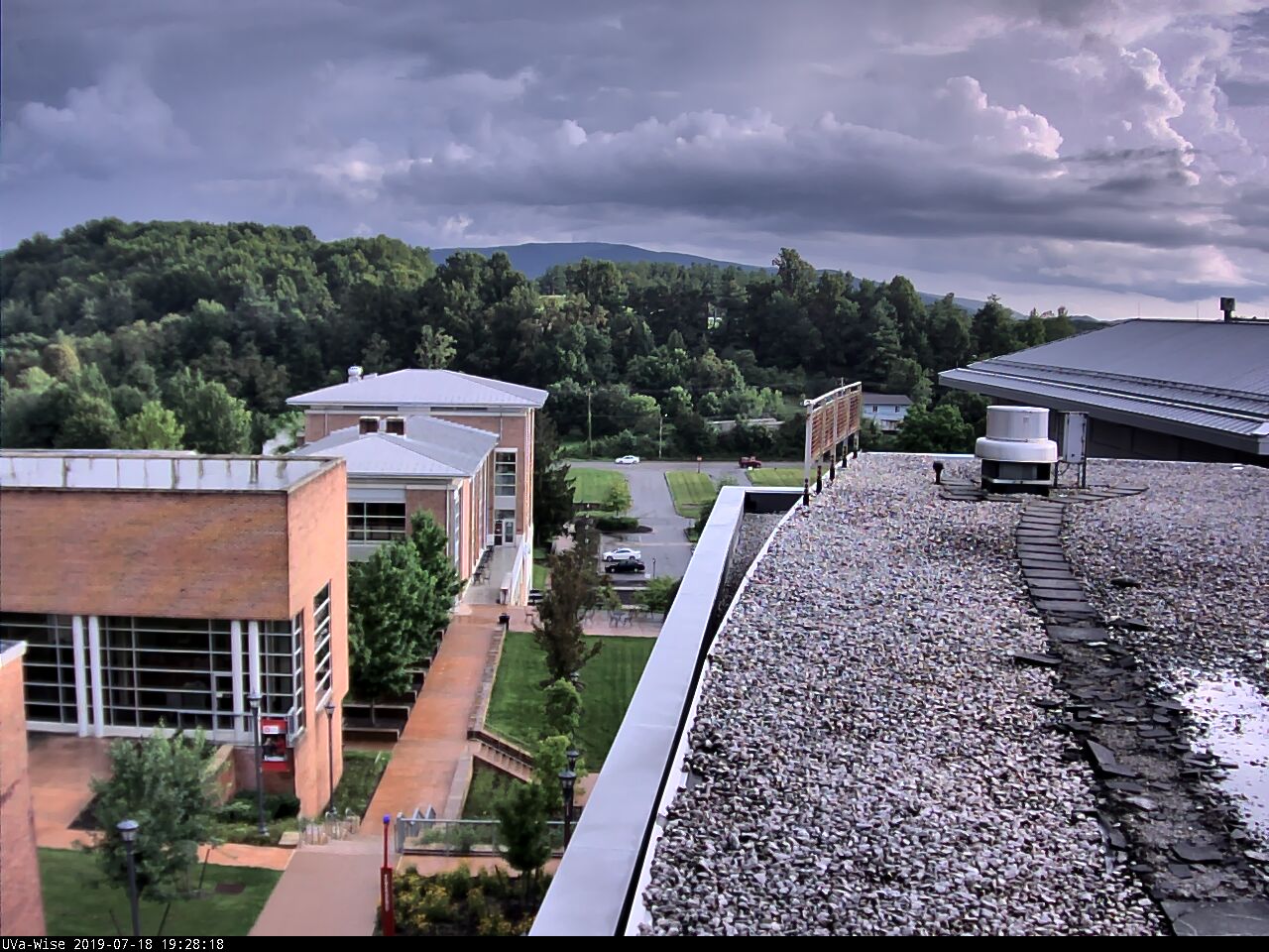
More dramatic scenes were captured July 18 as
air was lifted upward into the high country with building and back-building of thunderstorms that dropped more torrential rains.
July 18, 2019 at 6:02 PM
Clouds Being Lifted By Orographics-Convection

July 18, 2019 at 6:03 PM
Clouds Being Lifted By Orographics-Convection

July 18, 2019 at 6:04 PM
Clouds Being Lifted By Orographics-Convection

July 18, 2019 at 6:04 PM
Clouds Being Lifted By Orographics-Convection

July 18, 2019 at 6:05 PM
Clouds Being Lifted By Orographics-Convection

July 18, 2019 at 6:05 PM
Clouds Being Lifted By Orographics-Convection

July 18, 2019 at 6:05 PM
Clouds Being Lifted By Orographics-Convection

July 18, 2019 at 6:15 PM
Clouds Being Lifted By Orographics-Convection

Both 1-Hour and 3-Hour Flash Flood Guidance
values were exceeded over Big Cherry Lake Basin.

Doppler Composite 1-Hour Rainfall Totals

Locations from the western-southwestern side of the City of Norton through Powell Valley into the high country of the High Knob Massif received the burnt of torrential rains.
July 18, 2019 at 7:28 PM
Towering Clouds In Wake Of Heaviest Rain
July 18, 2019 at 8:53 PM
Sunset Over A Tropical Mountain Landscape


